ATTENTION:
Citizen Access will be unavailable Thursday, October 9 at 5:00 PM to Monday, October 13 at 6:00 AM for scheduled maintenance and updates.
We apologize for the inconvenience.
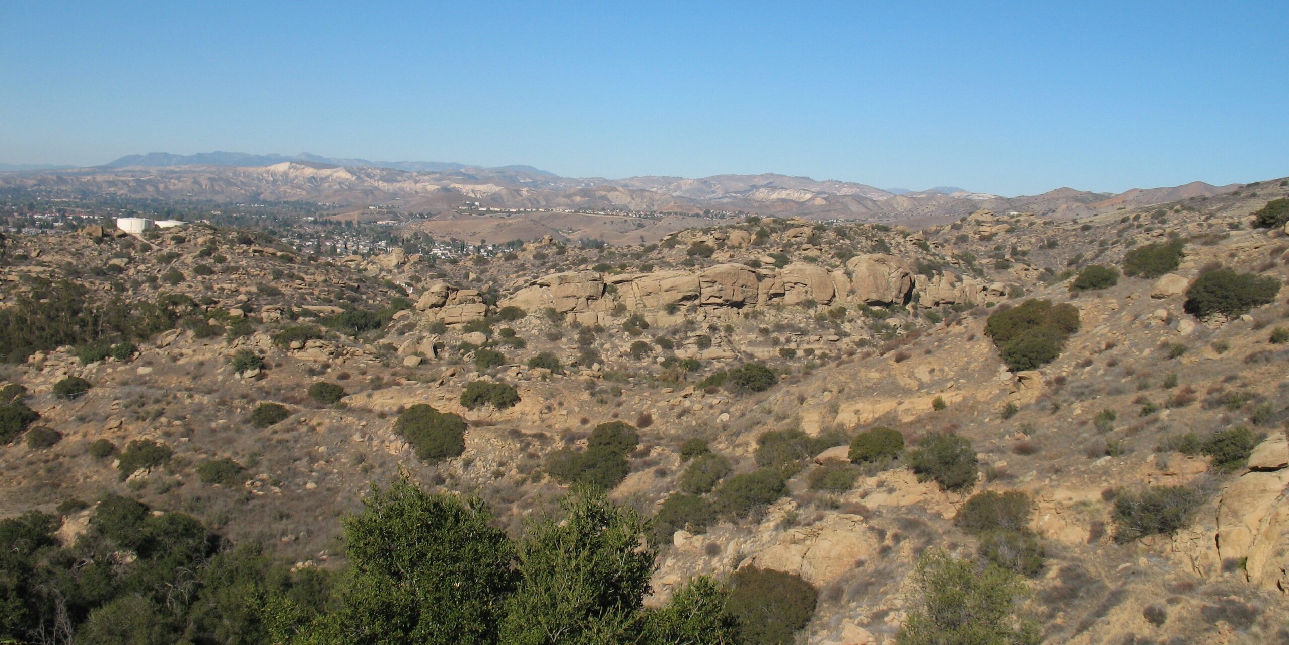
Simi Hills, 2016.
Ventura County Landmark No. 104: Stagecoach Road
Overview
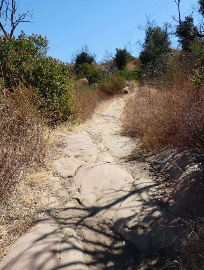
This approximately 3/4-mile segment remains of what was once the old Coast Line Stage Route (from Los Angeles to San Francisco) built in 1861 to traverse the Santa Susana Pass. The Ventura County section of the Stagecoach Road begins at the county line near the crest of the Santa Susana Pass and descends westward down a steep canyon into the Simi Valley where it emerges at what is now Smith Road (Maki, 2010). The road can still be seen south of the approach to the railroad tunnel at the east end of Smith Road and the bedrock roadbed shows evidence of the blasting required to fit it between steep mountainsides.
Stagecoach Road comprised a historic transportation corridor between Missions San Buenaventura and San Fernando and was once a segment of the famous Butterfield Overland Stage Route. In addition, the road was used by Wells, Fargo & Company as a route between Los Angeles and Santa Barbara. Stagecoach Road was the only way out of Simi Valley for early settlers to get their produce to market in the east until the Freight Road (Landmark No. 105) was completed in the 1890s.
Historical Background
Across the county line in Los Angeles County, California State Parks operates the Santa Susana Pass State Historic Park, which covers an area rich in natural and cultural significance and where the Simi Hills meet the Santa Susana Mountains (California State Parks, 2016). According to California State Parks (2016), “the last Spanish governor of California, Pablo Vicente de Sola, requested laborers from Mission San Fernando to widen and improve the pass to accommodate carretas (ox-driven carts), as well as herds of sheep and cattle. In 1859, the State and local counties funded a contract with James P. Thompson to improve the existing oxcart route to accommodate stagecoaches and flat-bottomed mud wagons. It opened in 1861 as the Coast Stage Line, used by the Butterfield Overland Company to deliver mail between Los Angeles and San Francisco.”
Upon its completion, Stagecoach Road, also known as “Pass Road,” served for the next 14 years as the main commercial route between San Francisco and Los Angeles (Maki, 2010). The road descended from the mountain pass to Smith Road, running westwards through the Simi Valley, following the line of present-day Los Angeles Avenue, to Ventura (Maki, 2010).
According to Maki (2010), “Overland Stagecoach discontinued service over Stagecoach Road in 1874, but a local stage line and farmers continued to use the road to transport travelers and crops between the San Fernando Valley and Simi until circa 1898, when a freight road was completed west of the pass. Some farmers continued to use the Stagecoach Road, but most abandoned it in 1917 in favor of the newly completed Santa Susana Pass Road.”
Current Condition
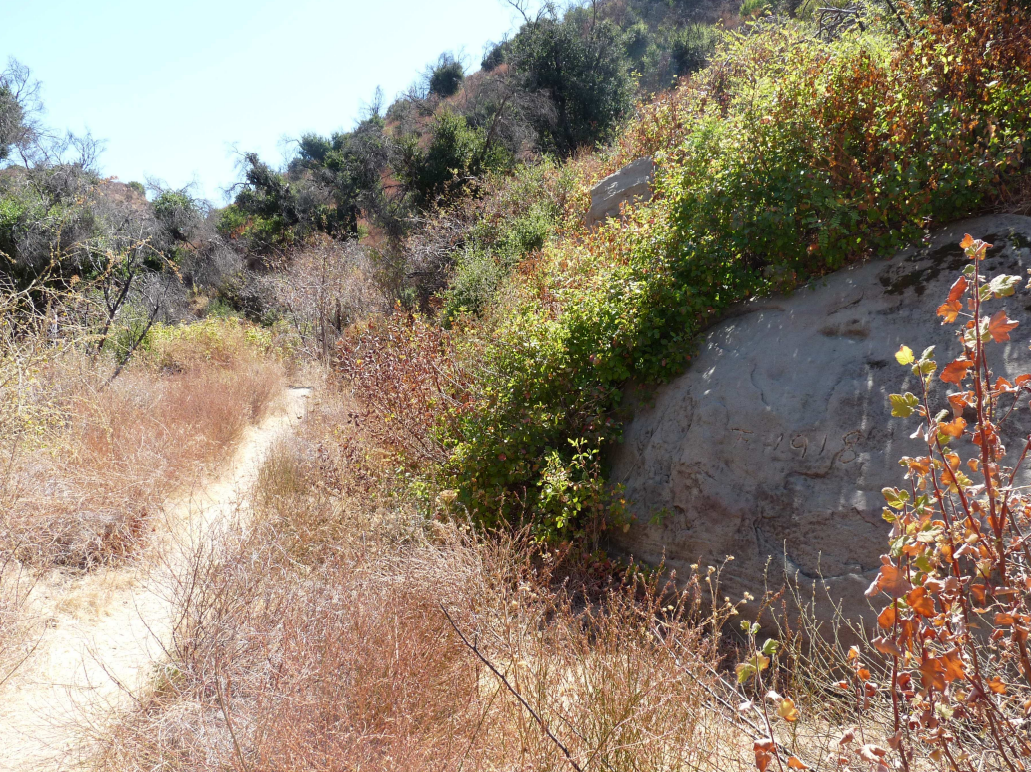
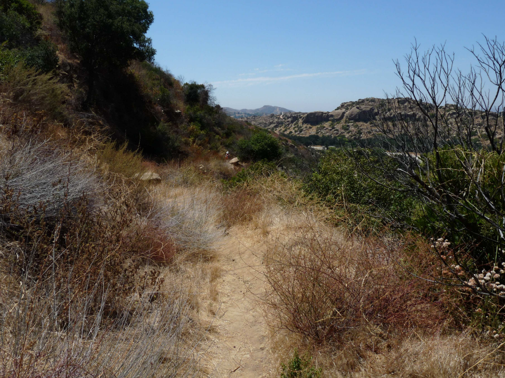
This historic route is overgrown except for a single-track trail. While still visible, the roadbed is overgrown and deteriorated, and characterized more as a trail than a road (Maki, 2010). According to Maki (2010), “evidence of dynamite blasting through bedrock is still present, as are pick marks on rocks and historic graffiti cut into rocks. Deep crevasses within the road are continuing to erode due to trespassing by dirt bikers and heavy rains.” The eastern portion of the road appears to follow Lilac Lane to the Los Angeles County line (Maki, 2010).
Additional Reading
Stagecoach Road Survey Evaluation, Mary Maki, Conejo Archaeological Consultants, September 11, 2010
Santa Susana Pass State Historic Park Cultural Resources Inventory Historic Overview, California State Parks, April 2007
Santa Susana Pass State Historic Park [Brochure], California State Parks, 2016
References
Bevil, Alexander D. (April 2007). Santa Susana Pass State Historic Park Cultural Resources Inventory Historic Overview.
Maki, Mary, M.A., RPA, Archaeologist (September 11, 2010). Calleguas Conduit Flow Control Facilities Project, Stagecoach Road Issue, Simi Valley. Ventura County Conejo Archaeological Consultants.
Date Designated: September 1986
Location: 2116 and 2114 McNell Road, Ojai
Photos:
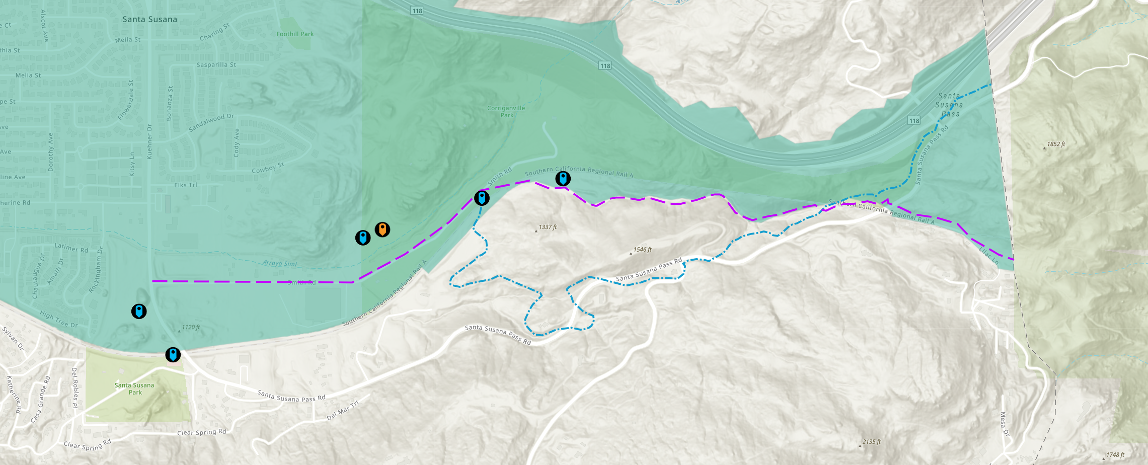
Approximate location of historical Stagecoach Road (purple line). The later Freight Road (Landmark No. 105) is shown in blue. Source: Ventura County Landmarks & Points of Interest Map.
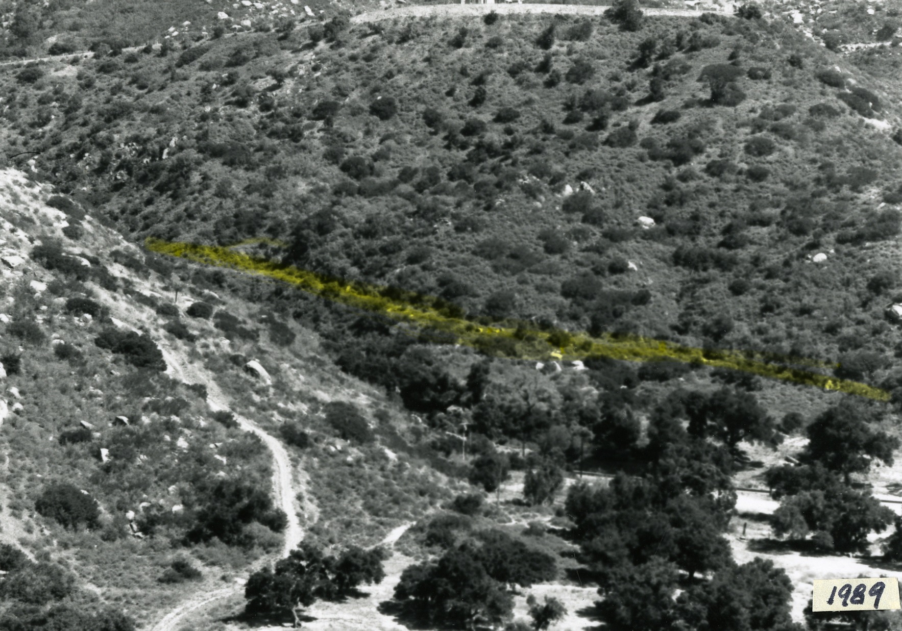
Photo of historical Stagecoach Road location (highlighted), 1989.
Photo of bedrock roadbed, 2010. Credit: Mary K. Maki, M.A., RPA, Archaeologist.
Looking east on Stagecoach Road, 2010. Note the date 1918 carved into the rock on the right. Credit: Mary K. Maki, M.A., RPA, Archaeologist.
Looking west on Stagecoach Road, 2010. Credit: Mary K. Maki, M.A., RPA, Archaeologist.
Translate Disclaimer
The vcrma.org website has been translated for your convenience using translation software powered by Google Translate. Reasonable efforts have been made to provide an accurate translation, however, no automated translation is perfect nor is it intended to replace human translators. Translations are provided as a service to users of the Ventura.org website, and are provided “as is.” No warranty of any kind, either expressed or implied, is made as to the accuracy, reliability, or correctness of any translations made from English into any other language. Some content (such as images, videos, Flash, etc.) may not be accurately translated due to the limitations of the translation software.
The official text is the English version of the website. Any discrepancies or differences created in the translation are not binding and have no legal effect for compliance or enforcement purposes. If any questions arise related to the accuracy of the information contained in the translated website, please refer to the English version of the website which is the official version.